Research
Within my research, I'm using different techniques to measure & collect (insitu and remote sensed) data, and finally combine them inside the numerical model using my ocean modelling expertise. In other words, I fuse together empirical (observations), theoretical (equations) and numerical knowledge (usually using supercomputers) to understand major ocean processes, and for example, effects they have on the coastal and offshore structures. To do that I am activity developing and implementing different types of ocean (ROMS and SCHISM) - wave (WWM III) - atmosphere (WRF) modelling systems. During the journey I often use advanced techniques such as 4D-Var data assimilation, and/or 2-way interconnected models which enables exchange of information during the integration.
2-Way coupled ocean-atmosphere-wave systems for tropical cyclones
Tropical cyclones (TCs) dynamics greatly depend on available heat and moisture energy they can draw from the warm ocean,
as well as on the sea surface roughness significantly modified by ocean wind-waves. Understanding of genesis and overall dynamics of TC systems has improved during recent years,
mostly influenced with our progress in better modelling and observations. Small-scale processes, such as inner-core TCs dynamics, are influenced by fluxes and interactions between
the ocean and atmosphere and are playing key roles in estimate of TCs intensities. Without correct boundary layer dynamics, and ocean-atmosphere exchange of fluxes, TC intensity
will stay poorly resolved and consequently under predicted. Today’s modern ocean, wave and atmosphere models bound together into dynamically consistent system capable of linking
processes between them and enabling improved TC intensity than in traditionally uncoupled approach.
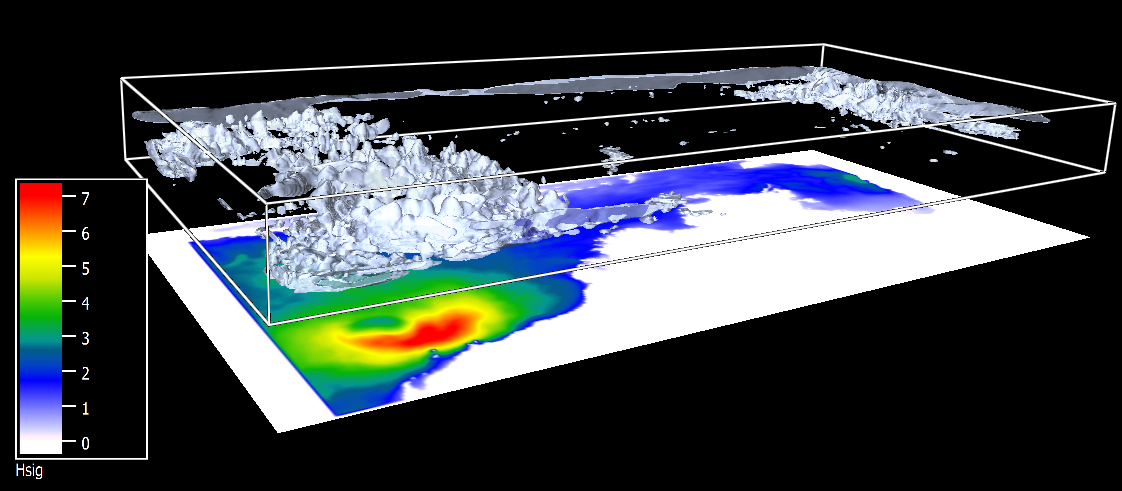
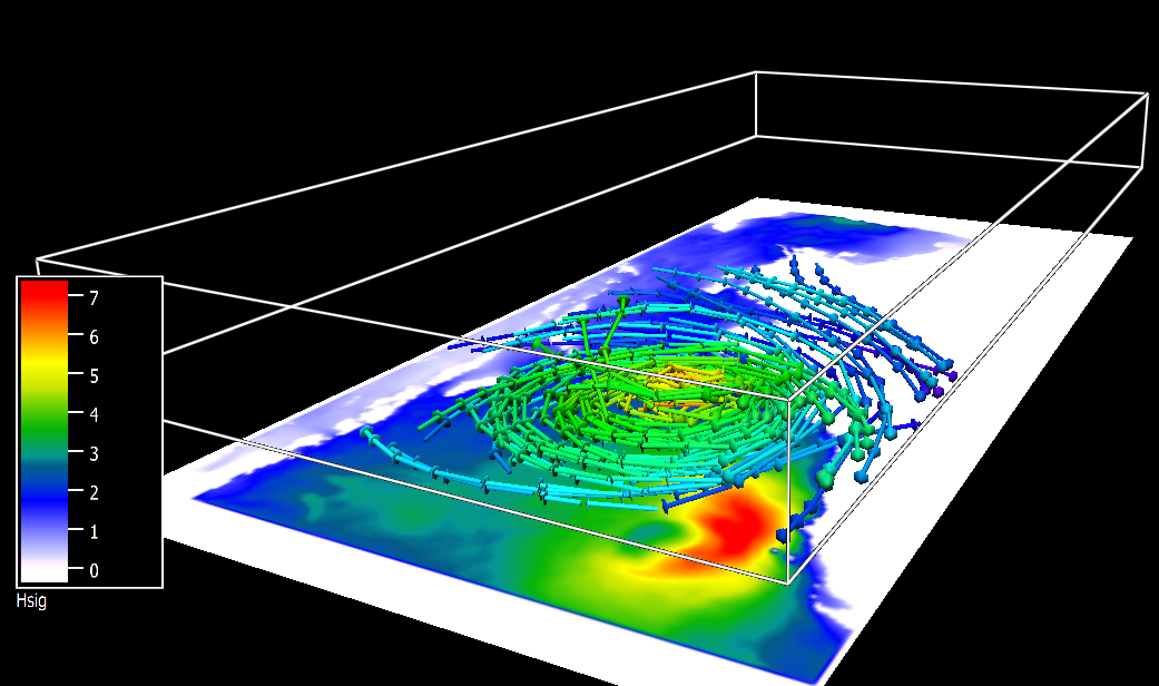
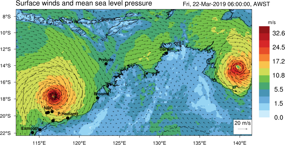
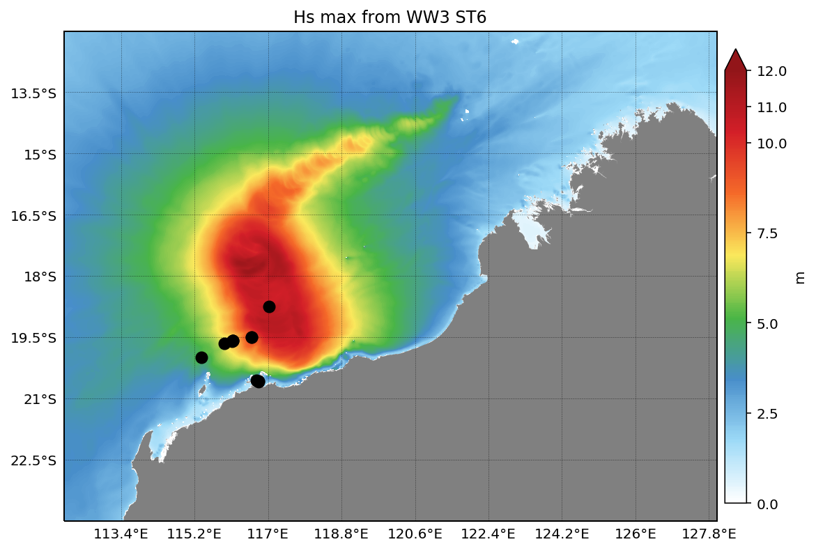
To expose benefits of my modelling system for North Shelf of Western Australia I chose TC Veronica using 2-way coupled atmospheric-WRF, ocean-ROMS and wave-WW3 models joined
together inside COAWST system providing realistic feedbacks during the integration.
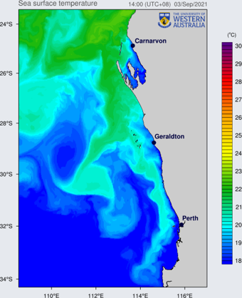
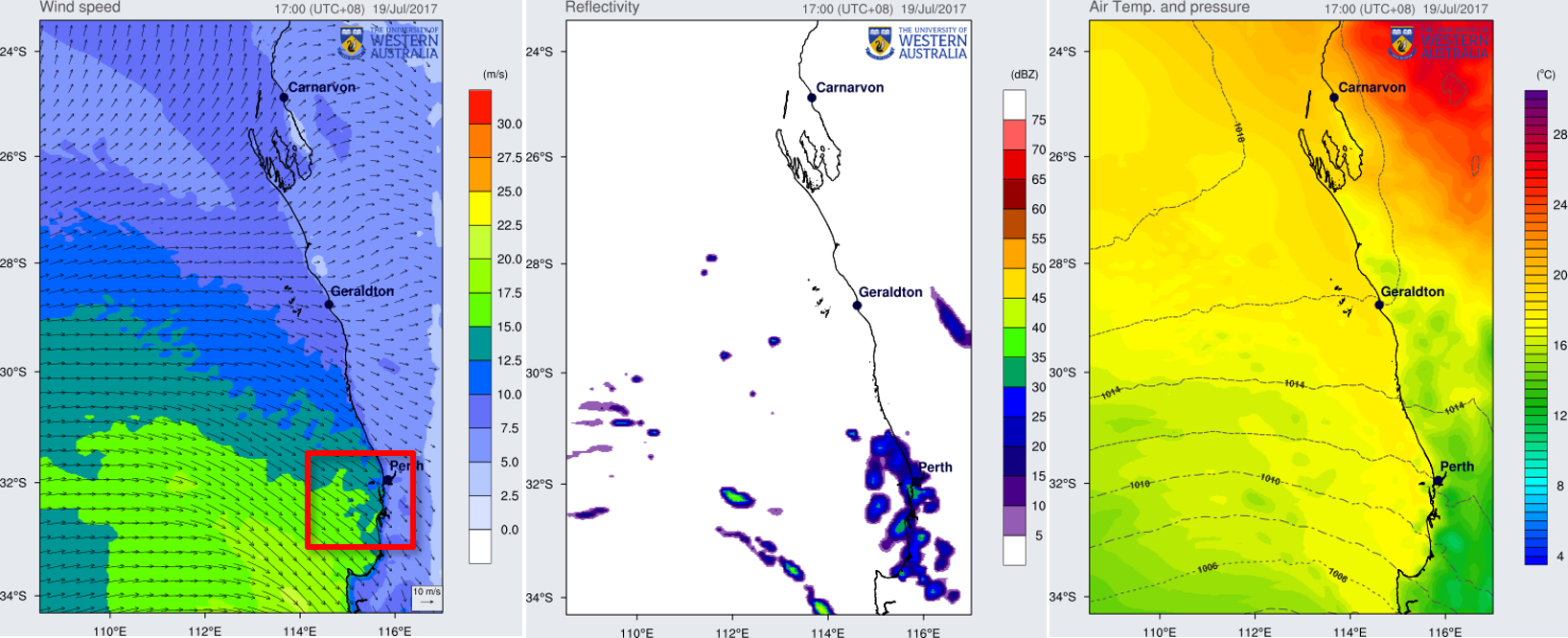
Ocean model provides information about SST (sea surface temperature) to the atmosphere model, surface ocean currents and sea level to the wave model and at the same time receives
feedbacks from the atmosphere model for updated surface heat and momentum flux, while from the wave model induced wave stress and contribution to turbulent mixing.
In parallel, wave model calculates wave dynamics and sends parameters of sea surface roughness to the atmosphere model which then adjusts air-sea boundary layer physics
and sends surface winds back to the ocean and wave models.
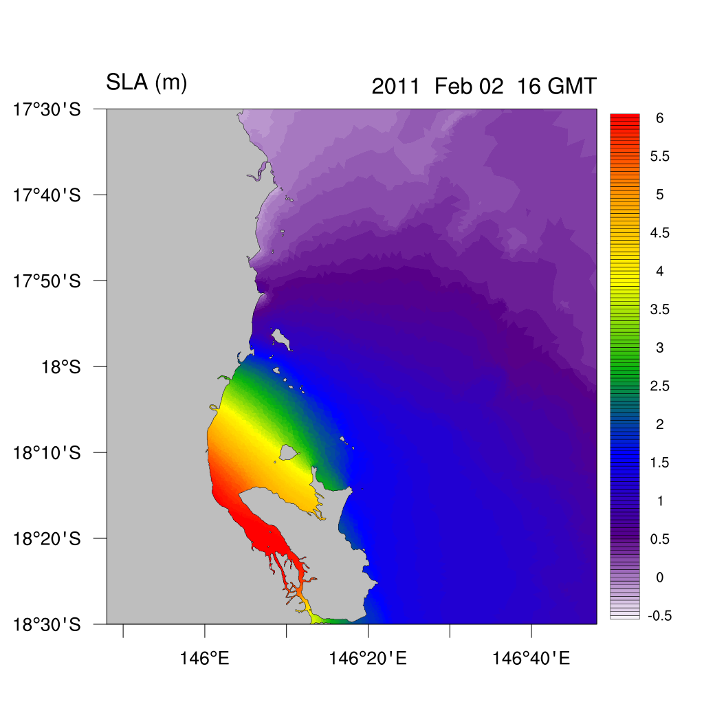
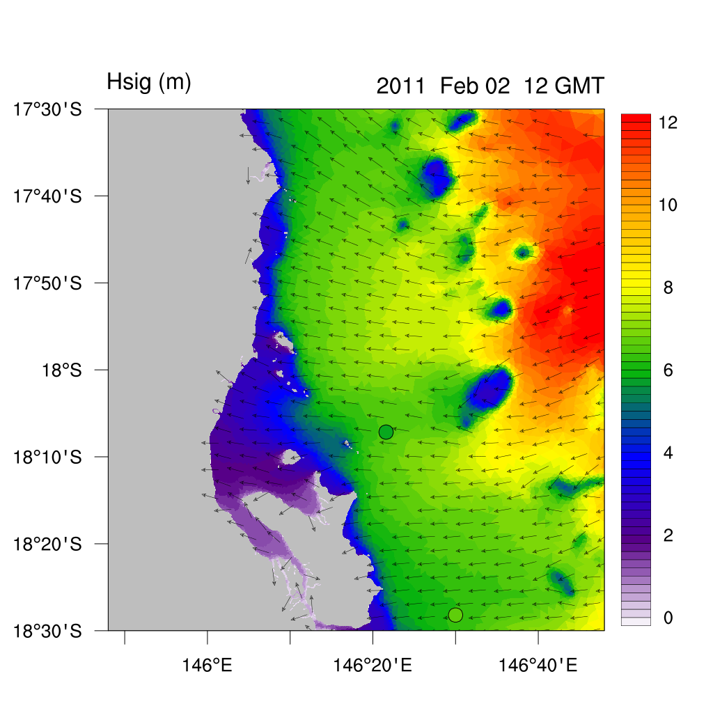
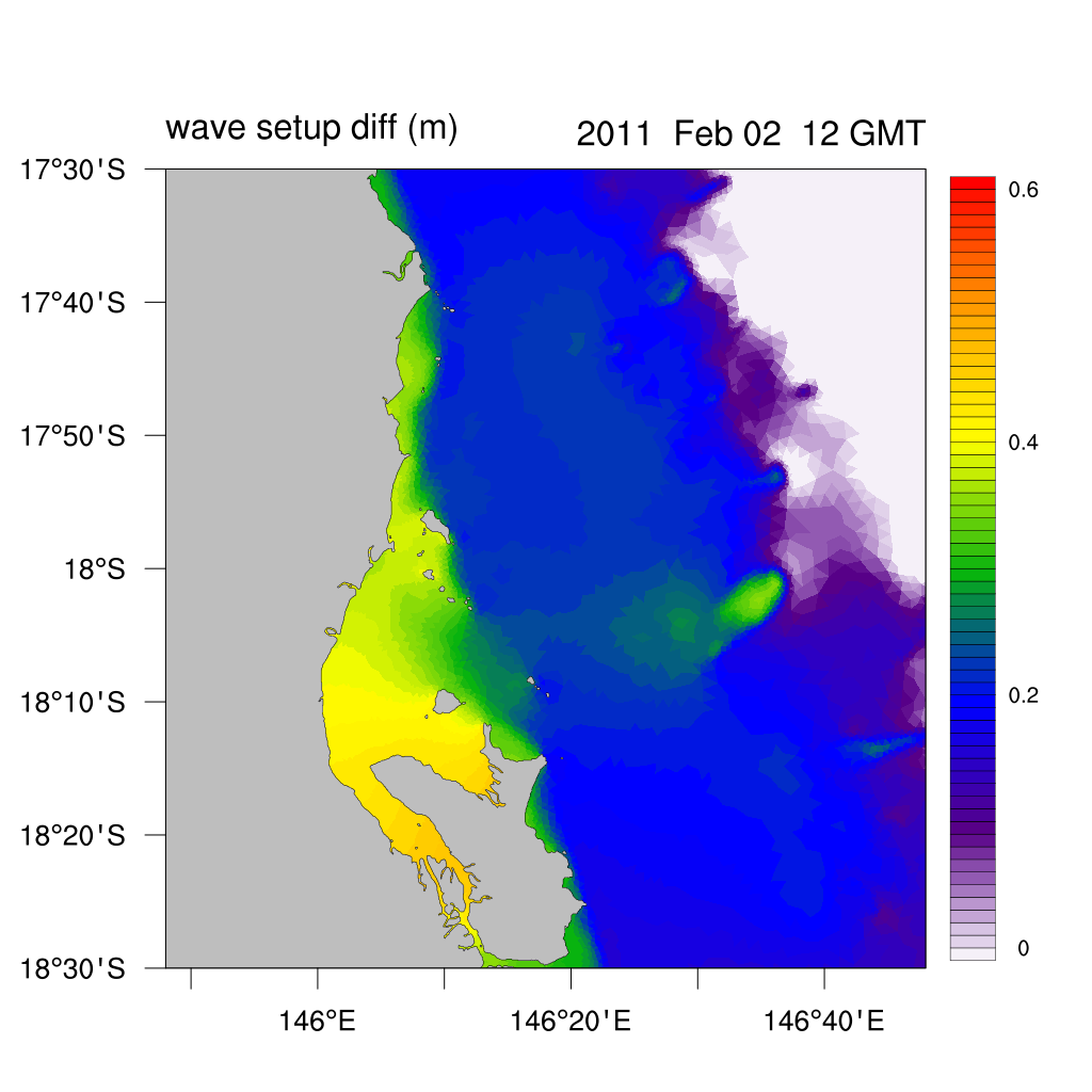
Another example of TC resolving modelling is when using SCHISM high resolution 2-way coupled system (ocean - wave), defined on the fully unstructured numerical grid (finite elements). This approach is crucial for resolving high-resolution storm surge effects in a complex coastal system. Unstructured mesh provides great flexibility for resolving domain features up to meter spatial resolution, while implicit time-step integration avoids small time-steps as in traditional explicit integration models (such as ADCIRC for example).
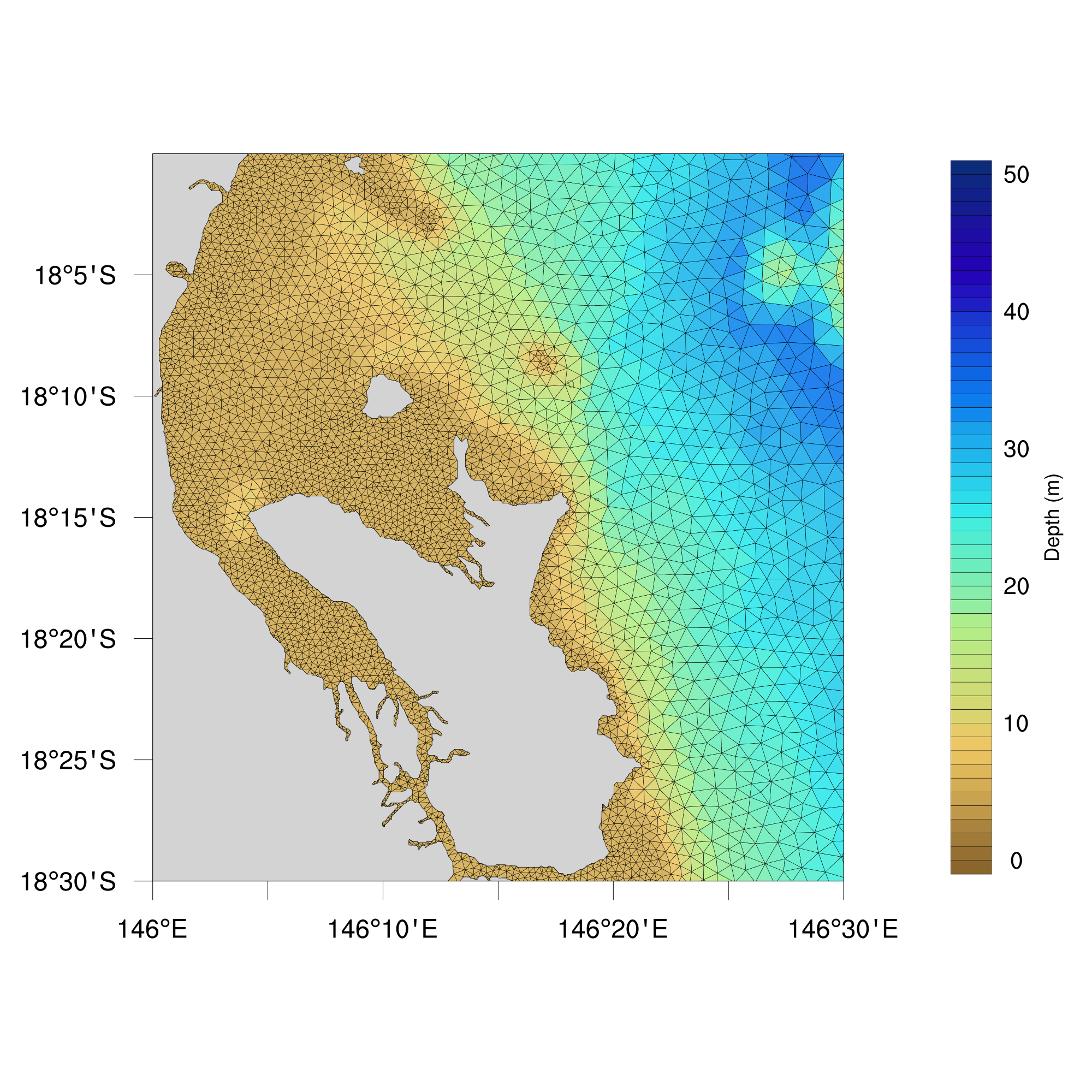
Incorporating 2-way coupled contributions of the wave-setup effects inside unstructured storm surge modelling was found important in the case of the TC Yasi (2001) at the QLD coast.
High resolution coastal ocean systems
Unstructured modelling
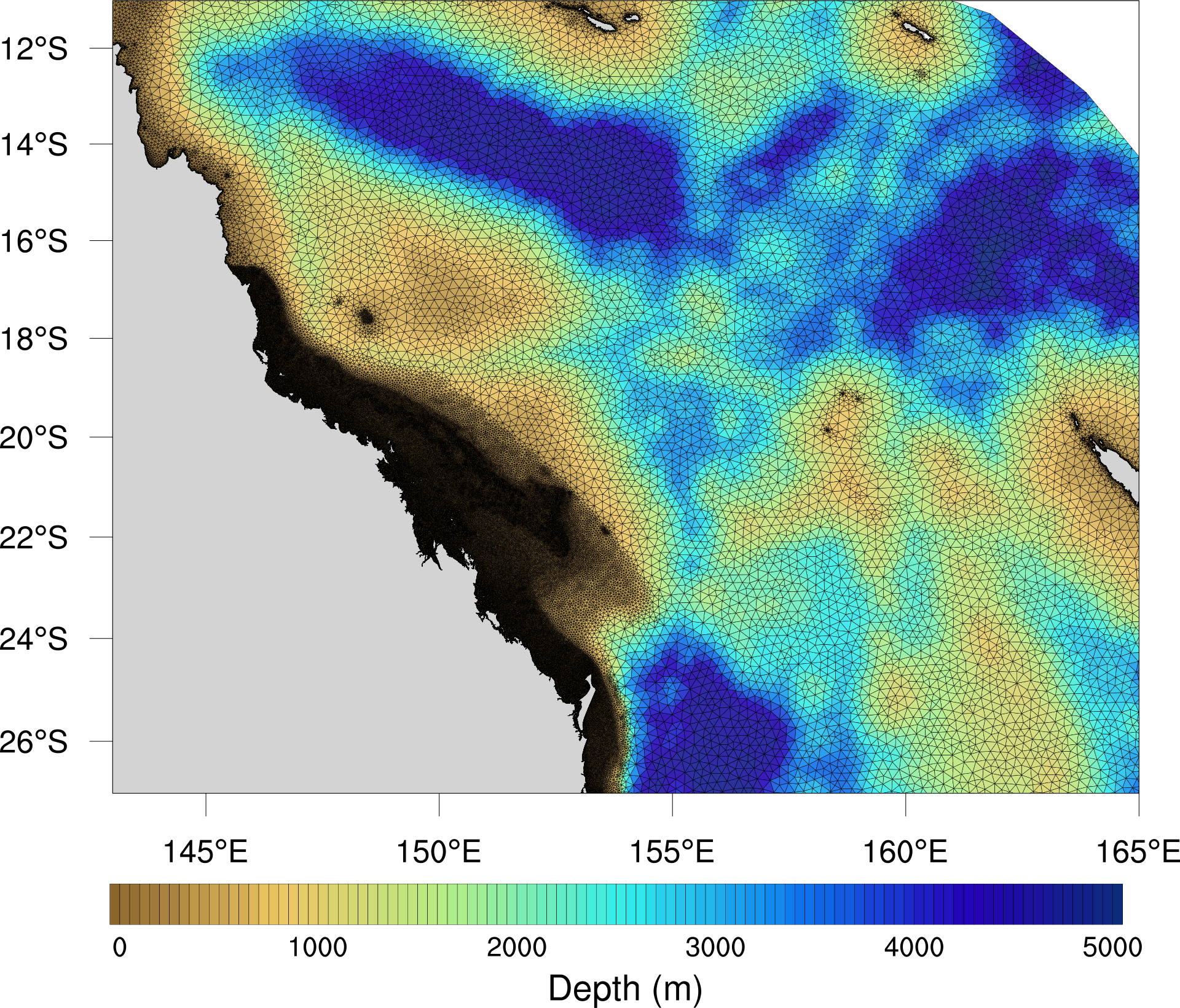
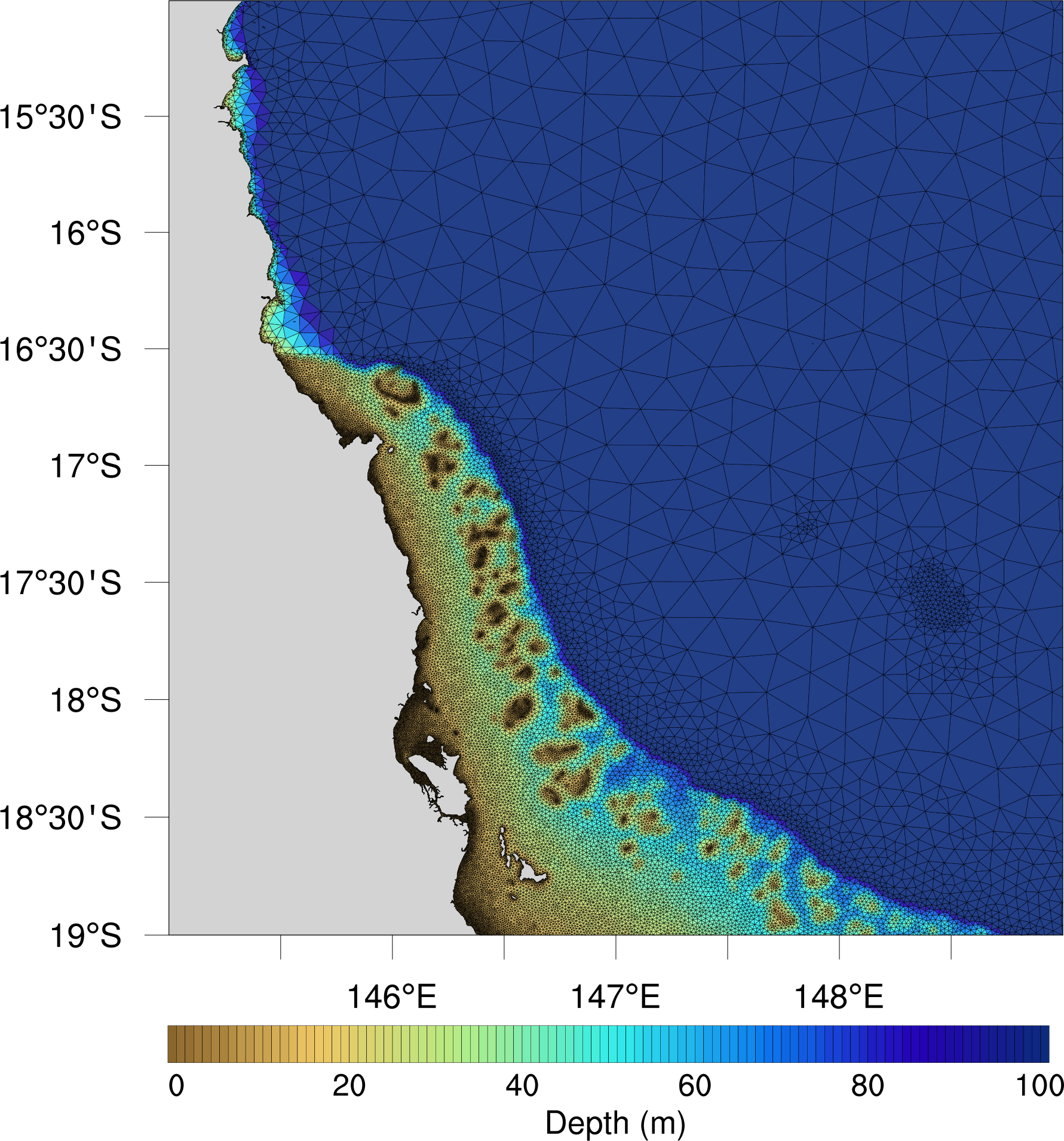
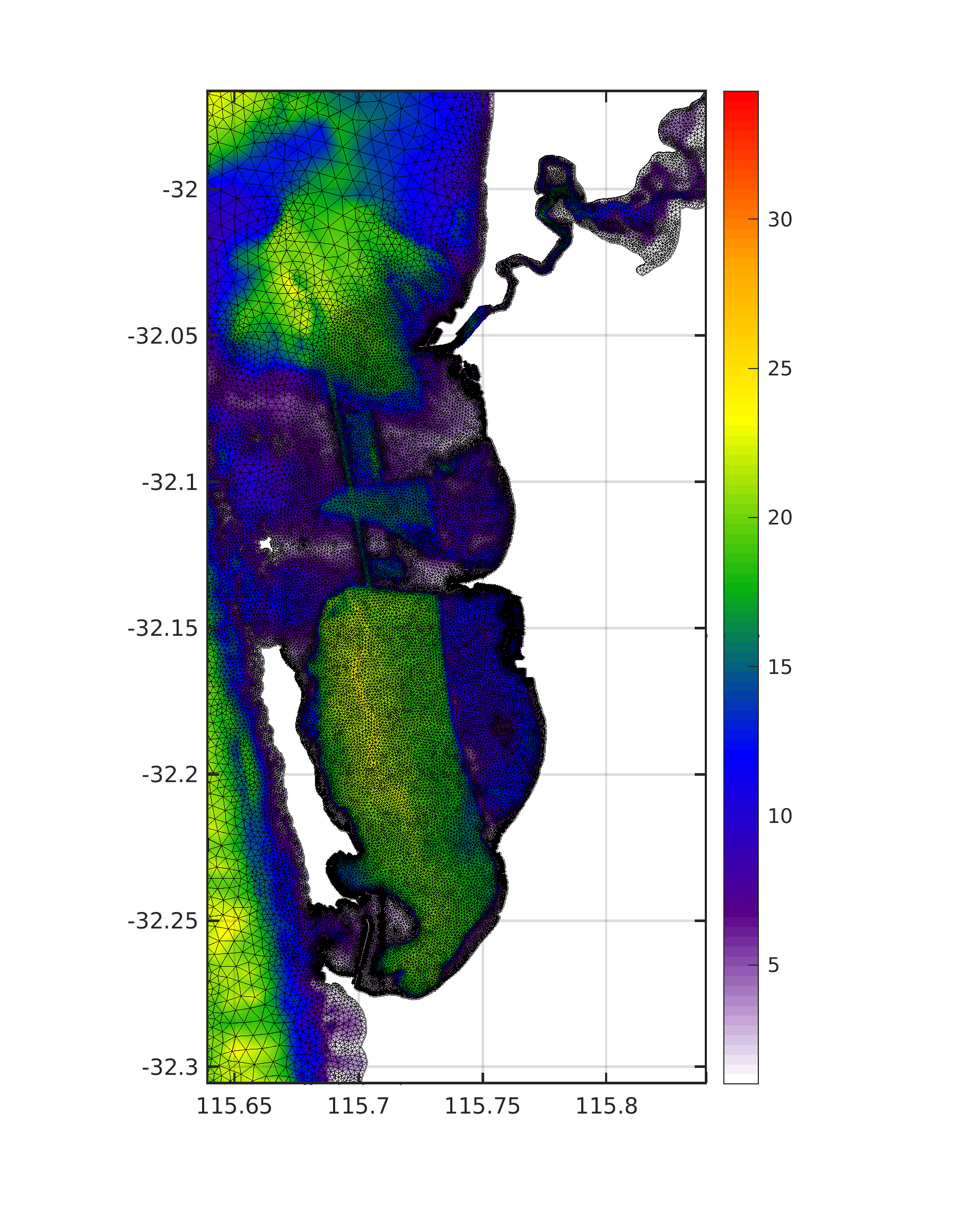
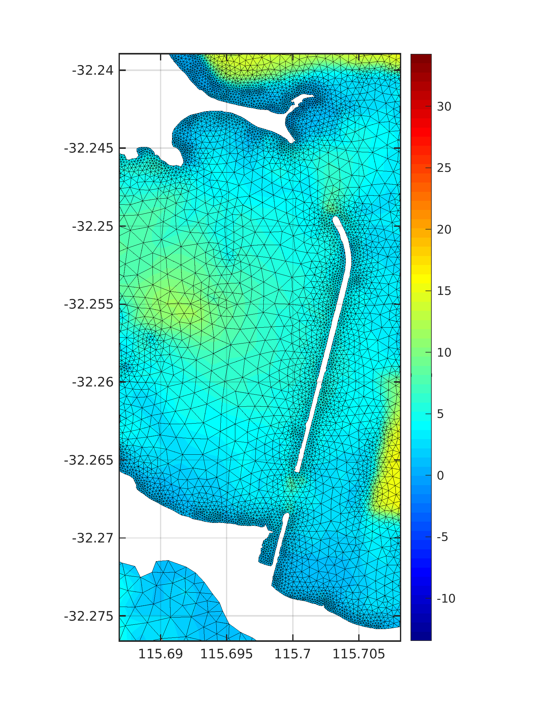
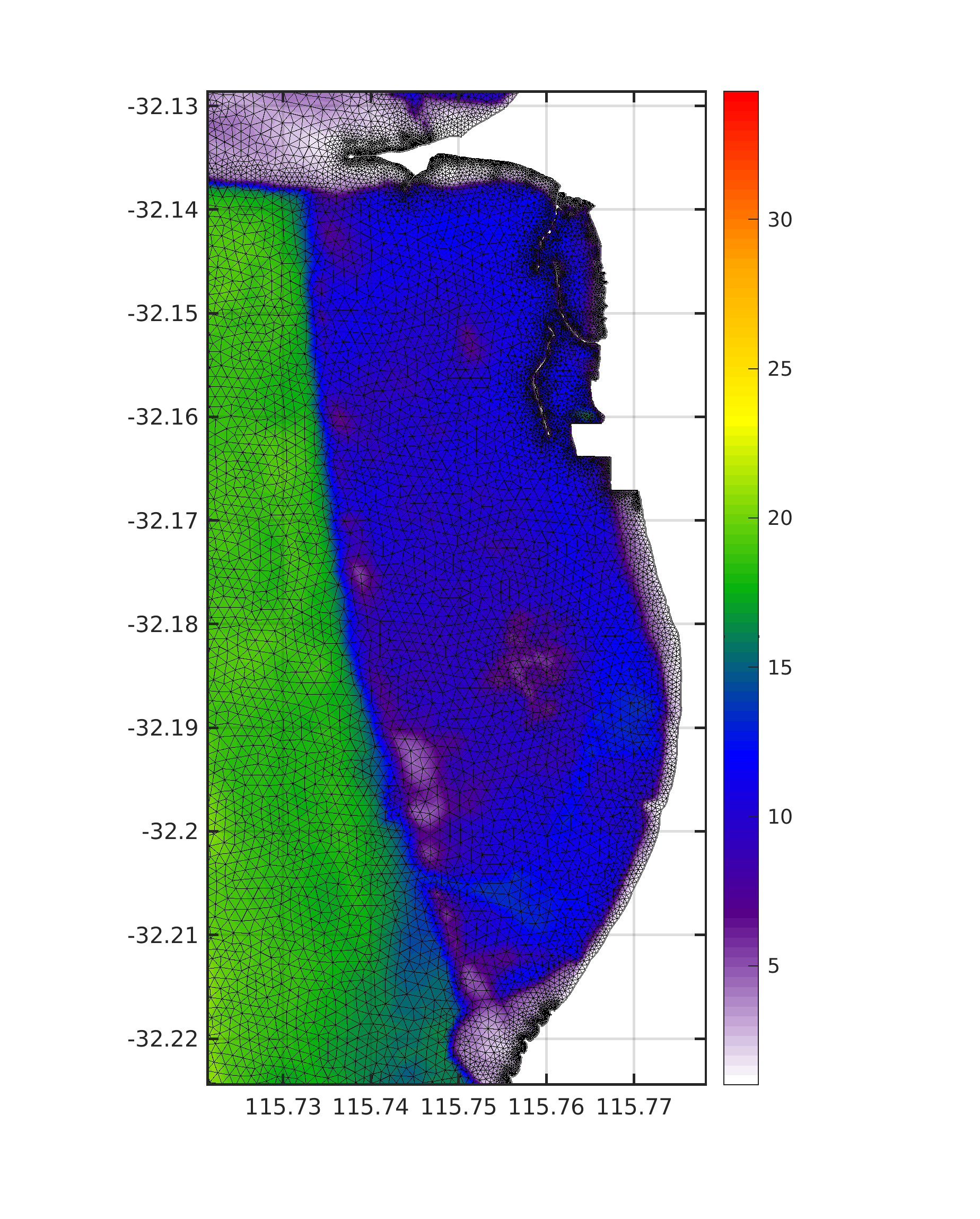
Using 3D SCHISM ocean model, but covering large domain - whole Australia, with implicit nesting due to unstructured grid I was able to resolve dynamics at the local coastal scales (~100 m resolution). This type of study was made possible by using ~ 1 mil.CPU hours at the Pawsey CRAY supercomputer.
Australia wide extreme sea level modelling based on a 59 years (1958-2016) hindcast resulted with present day extreme sea level statistics.
The high-resolution numerical model included the effects of astronomical tides, storm surges due to wind and pressure, and seasonal and interannual mean sea level (MSL) variability.
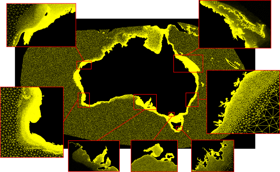
Downscalling on even finer super resolutions (~1m) for the Perth region is currently under way, model is nested inside real-time ROMS system....
Finite difference modelling
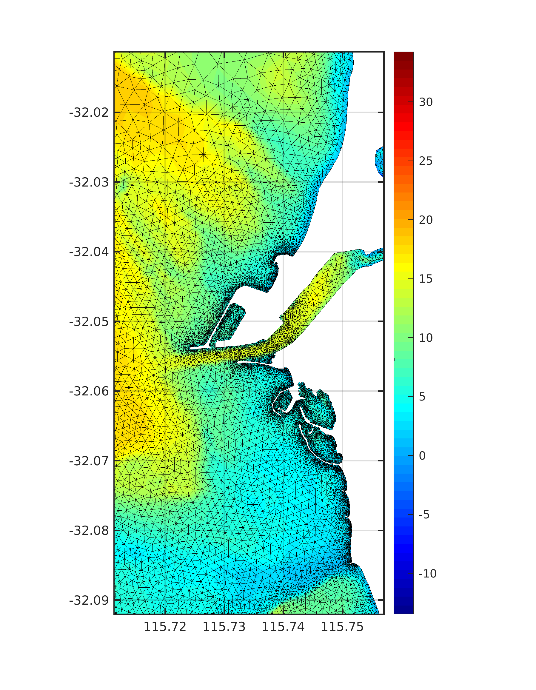
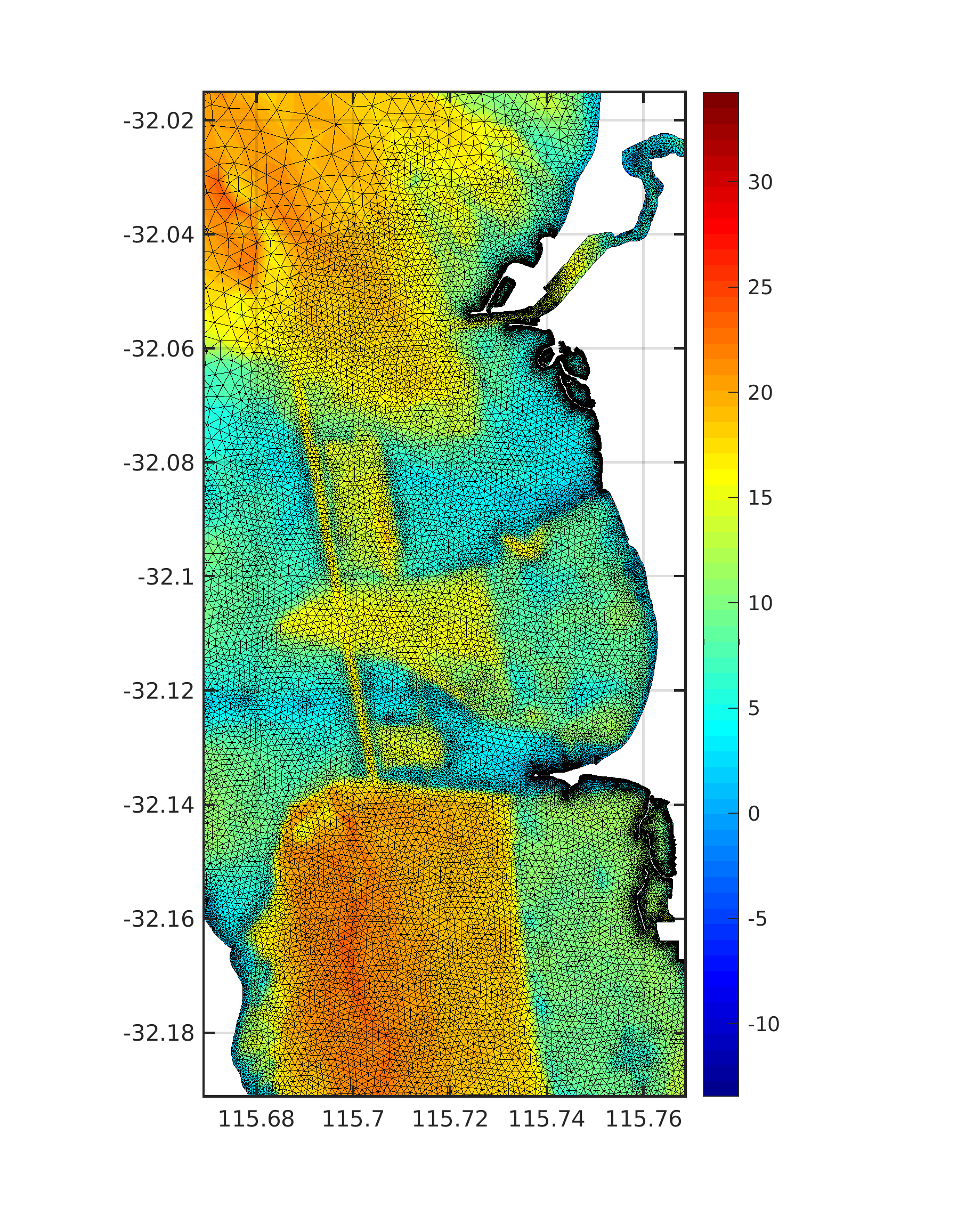
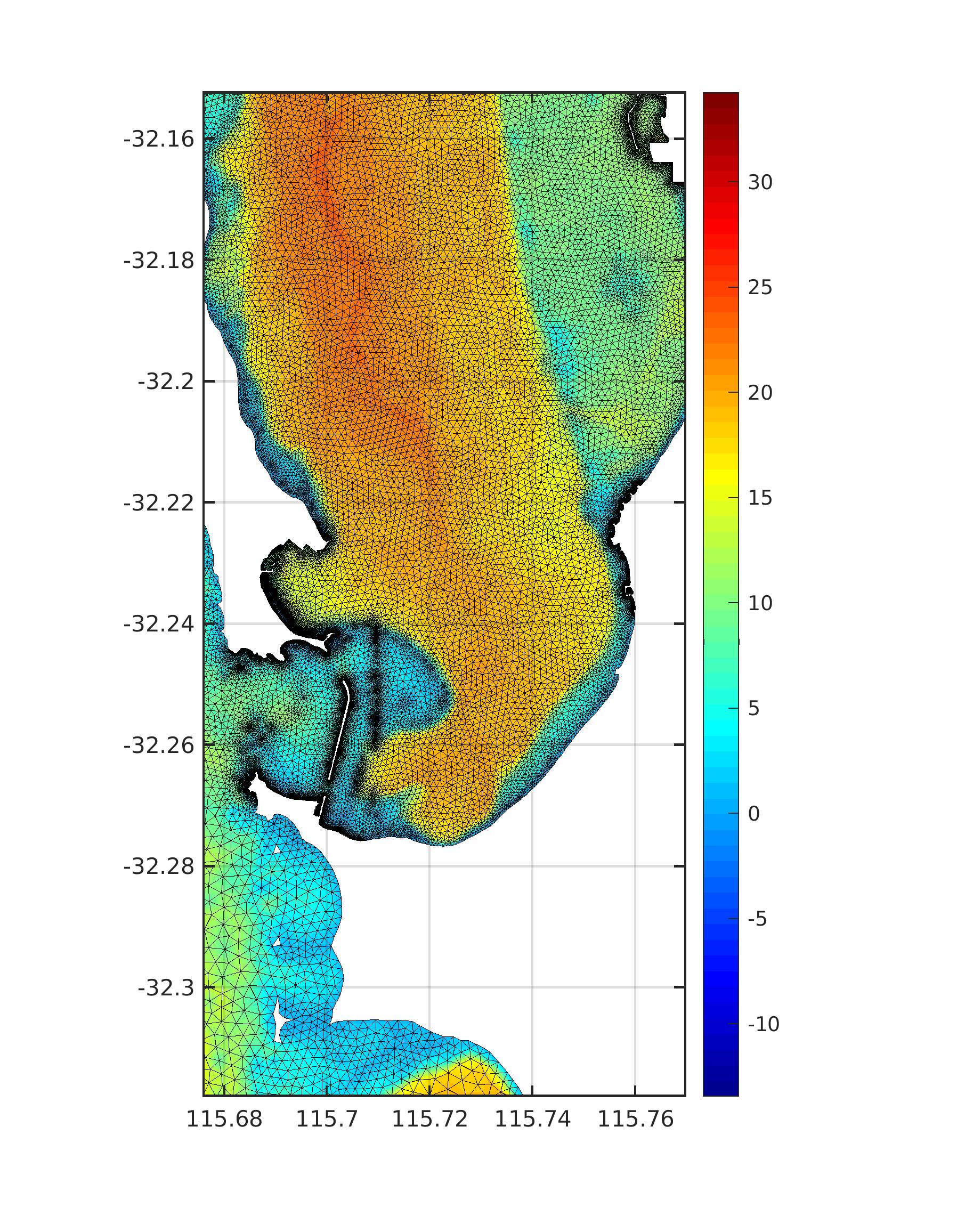
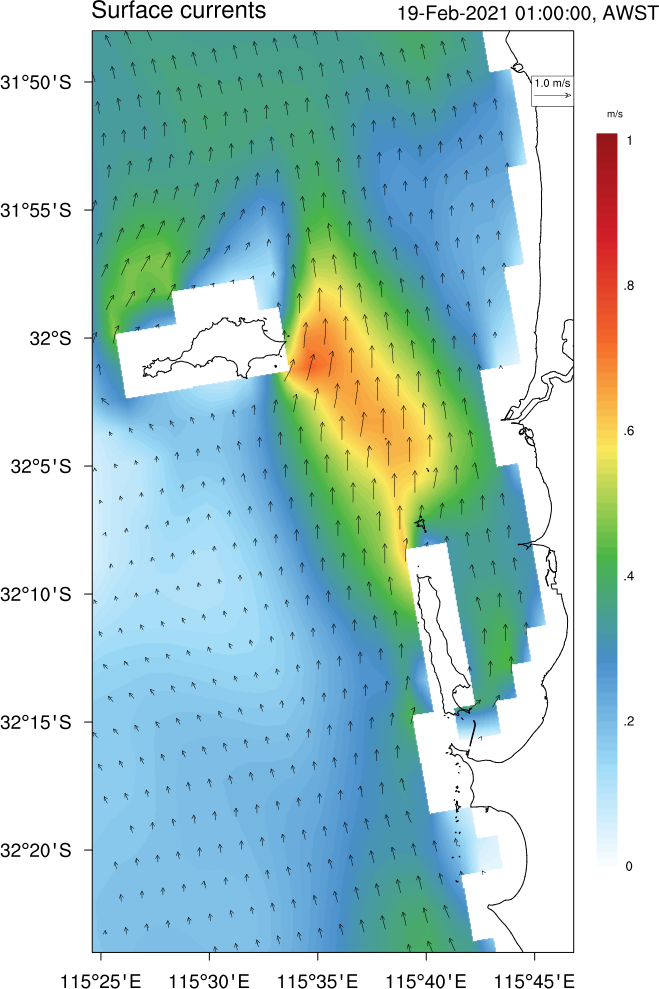
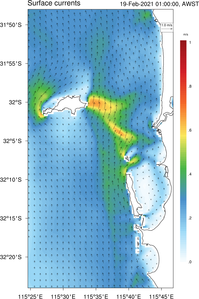
Using modern parallel 3D ocean model (such as ROMS), I am currently modelling ocean processes at the ~100 m spatial resolution employing nesting techniques. For the central region of the Western Australia I start with ~ 2 km resolution ocean model (covering whole western coast), then nest inside 500 m resolution Perth regional model, and at the end ~ 100 m resolution near shore model.
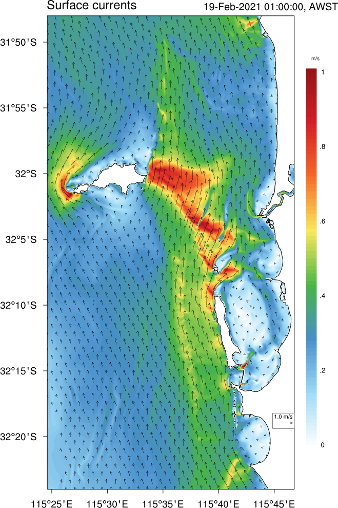
Next figure expose what features are resolved within each model setup (2km, 500m, or 100m) for the same coastal region (!). In other words, I am plotting 3 different model outputs, but for exactly the same area. It is evident why we need nesting (i.e. 2km ROMS solution is poor representation what is happening) for a complex coastal regions such as Perth / Rottnest island.
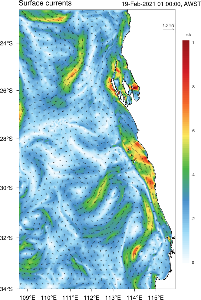
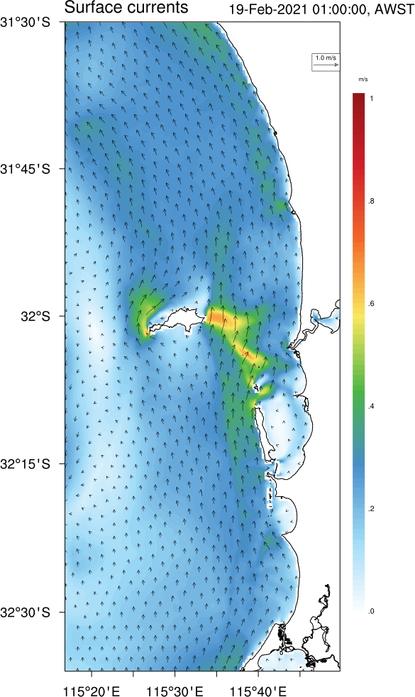
Real-time ocean - atmosphere modelling
My special interest lays in real-time applications and operational coastal ocean forecasting systems using atmosphere-ocean-wave (WRF / ROMS / WW3) in the 2-way coupled constellation with focus to quantify their predictability and uncertainty. To that end I am running operational atmosphere - ocean system based on the WRF model covering WA coast at 10km with 2-way nested 2km grid over the wider Perth region. In the ocean I am using ROMS model with 2 nested grids providing high resolution ocean fields. Those results are used for research studies as well as for public events as Rottnest Swim.
More to come (when I find time) ...